Cart
0
When your project demands both speed and accuracy, compromise is no longer acceptable.
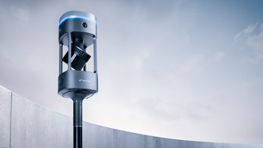
The Emesent GX1 is redefining mobile mapping by combining RTK precision, advanced SLAM technology, integrated 360° imaging and flexible deployment options in one powerful device.
If you are looking for a high-accuracy mobile LiDAR scanner that delivers reliable global positioning, repeatable results and simplified workflows, the GX1 is built for you.
What Is the Emesent GX1?
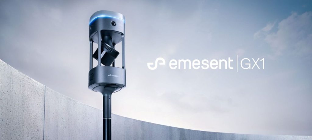
The Emesent GX1 is a next-generation RTK-enabled SLAM LiDAR scanner designed for surveyors, engineers, infrastructure professionals, mining operations and asset owners who require both local detail and trusted global accuracy.
It integrates:
- Premium RTK receiver with PPK support
- Advanced Emesent SLAM technology
- Hesai XT32M2X LiDAR sensor
- Four integrated 20MP cameras
- Flexible mounting options
- Cloud-enabled visualisation via Aura Cloud
The result is one device capable of handling complex indoor, outdoor, GPS-denied and hybrid environments without sacrificing data confidence.
Why Accuracy Is Everything in Mobile Mapping
Many mobile LiDAR systems produce impressive local detail. The problem is global alignment.
Without global accuracy:
- Floors do not stack correctly
- Multiple passes fail to align
- Measurements between areas cannot be trusted
- Drift accumulates across the site
The GX1 closes what professionals often call the “global accuracy gap”.
RTK-SLAM Accuracy You Can Trust
Using integrated RTK with optional local base station support, the GX1 delivers:
- 15mm 3D RMSE RTK-SLAM accuracy (1km baseline, no control)
- 5–10mm repeatable global accuracy
- Verified results measured against independent control points
- Improved drift and repeatability
This is not just precision. It is dataset confidence.
If you extract measurements from opposite sides of a site, you can trust the result.
Integrated RTK and Flexible Georeferencing
One of the biggest advancements in the GX1 is its georeferencing flexibility.
It includes:
- Integrated 448-channel RTK receiver
- 4G modem with nano SIM support
- PPK capability
- Support for control points where required
Whether you are mapping:
- Open outdoor infrastructure
- Road corridors
- Industrial facilities
- Urban environments with partial GNSS obstruction
- Indoor or underground spaces
You can configure your georeferencing strategy to match the environment, not fight it.
LiDAR and Imaging Performance
LiDAR Specifications
The GX1 features the Hesai XT32M2X LiDAR sensor:
- 300 metre range
- 640,000 points per second (single return)
- 1,920,000 points per second (triple return)
- 32 channels
- Proprietary static-dynamic LiDAR-IMU calibration
This enables fast capture of dense, high-quality point clouds across large environments.
360° Integrated Cameras
The GX1 includes four integrated 20MP cameras delivering:
- 360° x 142° field of view
- 0.96mm per pixel at 1 metre
- 4.8mm per pixel at 5 metres
- Automatic masking of people
- Configurable image masking options
The improvement in image clarity and colourisation quality makes inspection, stakeholder reporting and asset documentation significantly more powerful.
One Device. Any Project.
The GX1 is designed for deployment flexibility.
Backpack Mount
- Ergonomic straps
- Extendable pole to raise scanner above the head
- Case doubles as backpack mount
- Ideal for large area scanning
Survey Pole
- Compatible with 5/8” thread
- Familiar workflow for surveyors
- Stable and flexible
Supported Handheld Harness
- Designed for tight or complex indoor spaces
- Clip-in and clip-out flexibility
- Ideal for constrained environments
Vehicle Mount
- Rapid scanning of large sites
- Secure configuration
- Available as optional accessory
Instead of buying multiple scanners for different workflows, the GX1 adapts to your project.
Faster Workflow, Smarter Setup
Productivity improvements matter when you scan multiple sites per week.
The GX1 introduces:
- Effortless configuration in Commander
- Simultaneous LiDAR and camera data offload
- USB-C, WiFi or SD card offload options
- Integrated removable batteries
- Approximately 60 minutes scan duration per battery
- Dual bay battery charger
- Clear error codes and system warnings
Less time configuring. More time capturing.
Aura Cloud: 360° Visualisation Without Barriers
With Aura Cloud, stakeholders can access:
- Browser-based point cloud viewing
- 360° walkthrough experiences
- No installation required
- No viewer license barriers
- Seamless integration into existing workflows
- Trimble Connect integration
Data automatically uploads from Aura after processing, allowing rapid sharing across teams, clients and decision-makers.
This is critical for infrastructure, utilities, construction and asset management environments where non-technical stakeholders need spatial understanding quickly.
Technical Overview
Weight 3.2kg without battery 3.5kg with battery
IP Rating IP65
Operating Temperature -10°C to 45°C
Storage 2TB onboard Optional SD card expansion
Connectivity Integrated 4G modem PPK support
This is enterprise-grade hardware designed for demanding environments.
Who Should Use the Emesent GX1?
The GX1 is ideal for:
- Surveying professionals
- Civil engineering teams
- Rail and transport authorities
- Mining operations
- Utilities and energy infrastructure
- Asset inspection specialists
- Construction and BIM professionals
- Industrial facility managers
If your organisation depends on accurate spatial data to make decisions, the GX1 reduces risk and increases confidence.
Why Choose Coptrz for Your Emesent GX1?
Selecting the right mobile LiDAR scanner is only part of the equation.
You also need:
- Technical consultation
- Implementation guidance
- Training and onboarding
- Workflow integration support
- Ongoing technical assistance
We help organisations deploy mobile mapping solutions correctly from day one, ensuring your investment translates into measurable operational impact.
Final Thoughts: Closing the Global Accuracy Gap
Mobile mapping is no longer just about collecting dense point clouds quickly.
It is about collecting data you can trust.
The Emesent GX1 combines RTK precision, SLAM reliability, 360° imaging and cloud-based collaboration in a single, flexible platform.
If your projects demand both speed and true global accuracy, this is the scanner designed to deliver both.
Ready to See the GX1 in Action?
Speak to our team today to arrange:
- A technical consultation
- A live demonstration
- A commercial proposal
- A trade-in assessment